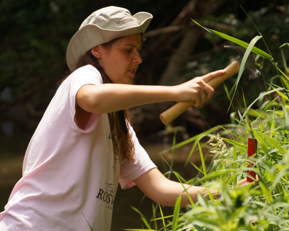
Friday, July 26, 2013

Presentation

 Today's presentation was fabulous!  Forrest and I were very impressed.  Congrats on all your hard work.

During the presentation...

Done with the presentation! 

Friday, July 19, 2013

I tried opening the first twinned image in AgiSoft StereoScan.  The 3D model it created doesn't look completely crazy (see image below).  It can be exported as a *.ply file. (the format we think could help us with photosynth), but we don't really know what we're doing with those *.ply files and these won't have nearly as much stream outline included as the multi-picture photosynth ones. 
screen shot of first twin set

Wednesday, July 17, 2013

Powerpoint Thoughts

I just finished compiling PowerPoint slides of the GUI I have been creating and realized that without a live demo of the program the PowerPoint is best with just pictures and me tying them all together during the presentation.  Perhaps a live demo will be possible, not sure as of yet but it is definitely worth considering.
The camera's GPS is clearly not good enough.  :) 
An average of 289% error, between both cameras...  We can only get better with our other methods.
Timelapse video of our field day!

possible GPS conversions

Tuesday, July 16, 2013

Nettles, biting flies, and beams oh my!

After a long 12 hour day collecting data in the stream, I can definitely say I was pretty worn out but being able to get all of the data in one day was essential. When we began planning in the beginning of the term, I never expected that we would have so many different methods to try. We used the GPS feature of the camera to get longitude and latitude coordinates of the waters edge on the banks. We used a tripod "twinning" cameras method to take pictures that could be used to create 3D images of the stream. As with the first practice "field day" the square method was also utilized but with slight modifications this time. In addition to using the square to obtain horizontal and vertical lines, we also placed the square in three different locations and tried to include as many control points in pictures as possible as a means of testing the accuracy of the perspective correction. David and Kyle were busy taking hundreds of pictures to be used in the Photosynth software.
The non-photo methods were a lot more frustrating then I had hoped but they turned out a lot better than I expected once we got a system down and started. Maybe we didn't think them through as well as the others or expected the control points to be on the edge, but either way, we found a solution quickly.
There's just some things that a classroom can't prepare you for and I learned a lot during our field day. Spending the day outside was great, the weather was a little humid but we had lots of shade and thankfully lots of water :) The most important thing it taught me was that you will always learn something new and you may never be able to be fully prepared for research no matter how much thought you put into it. For example, in the classroom, I never thought about the interference of branches at the surface of the water that would hinder data capture or control point placement. Some of the control points couldn't be placed on the water's edge and we needed to brainstorm other ideas on the spot, so being slightly flexible is key. I learned that you can NEVER take too many notes. With all the confusion of trying to sort out the data I wish we would have written some more notes so we could better analyze the data. Learning to/determining a common way of using the ruler definitely wouldn't have hurt either, and once again, that's one thing I never expected would cause us any trouble.
Overall, we got a lot of data (suffering some minor aches and pains as the title suggests) and we'll be very busy these last two weeks sorting it all out and hopefully getting some conclusive results to show for all of our hard work!

Field Day 12 Hours!

Our field day to Blackhawk creek was unlike anything I had expected.  The day began out with a simple task of placing our thirty pre-made and marked control points.  From there we then began to measure distances between the control points in two teams of two and then compared our results which surprisingly enough were spot on for the majority of them.  From there we each began photo methods.  I began to do a photosynth method which consisted of me walking up and down the center of the bank, and up and down the center again first looking at one bank and then the other taking pictures all the while (217 to be exact).   Then I began the video method wherein I took 15 second videos while walking down either bank.  Then as a team we lowered down the 8ft by 8ft wooden square and began to place it at three intervals along the 122ft stretch of stream.  At each interval we all took pictures from as many differing angles as possible to capture all four corners and as many control points as possible for our later quantification.  After the square we split off into two teams (The Stonedahl's and the Students).  The Stonedahl's began work on the triangulation method which from their output in the excel sheets looked to be a very arduous but hopefully rewarding task.  The students embarked on what was probably the most time consuming method of the day.  First poles were placed at 15ft intervals down the length of the stream, this seems easy but you try putting in stakes when there are rocks everywhere.  Next lengths of string was wrapped around the bottom of the poles, and at each foot a black mark was placed.  From this point we went up and down both banks placing tape at the horizontal crossing point of each control point and measured the distance from the string to the control point.  Next we measured the distance from the string to the banks every three feet.  After this method came to its conclusion we began to pack up and head home after a 12 hour long field day, tired, muddy, and with hope.

Further Field Day Photos & Narrative

Of course, we were all too tired yesterday (after 12 hours wading in Blackhawk Creek) to post photos & stories to the blog.  So belatedly, here are a few more photos to paint a picture of the day:

We juggled clipboards.

We measured distances and put up signs.

We were careful not to bump our heads on beams.  Okay, okay, some of us were careful, and others of us suffered.
We assembled large wooden squares...

...and got some unexpected help moving them around!

We took pictures.

We took more pictures.
(For the insatiably curious: 1. no, we didn't see any deer, and
2. yes we did have prior approval from Davenport Parks & Rec.)
We took even more pictures.
We took yet even more pictures.

Sometimes we even took random artsy photos of yellow rope.  (Okay, okay, I guess only I did that.

We toted the square around more.  Turns out we *can* do it without construction workers' help.


We synchronized our cameras to our clipboards.

We synchronized our stomachs to Subway sandwiches (while fending off a few biting flies).  That reminds me  that I forgot to take any pictures of the infamous nettle patch.  Oh well.

We tossed large wooden squares off of bridges.  (Carefully).

And toted them around *in the muddy water*.

We filled up our boots with water and emptied them again. 
Okay, okay, only Michelle did that, but she did it often enough to count for the rest of us. 

We hammered in posts.

We performed the ancient Blackhawk Creek square dance, wherein one must perform acrobatic feats to avoid tripping over yellow ropes and getting drenched in muddy water.  (We all did that, but only David's dance steps were properly caught on camera.)

"Sometimes floating is better than toting" -- you can quote me on that.

Happiness is...

... a productive day of field work.
(Or have we all just been preconditioned to "smile for the camera" from an early age?)

Forrest and his macro lens gets distracted by some pretty flowers.

And other things.

We beautifully aligned poles (even though the tall one Kyle is holding here always wanted to lean a bit.)

And after much, much more measuring, we all went home exhausted... but cheered by the prospect that we had done a good enough job that we wouldn't have to do it all over again!

Fabulous Field Day

We had a fabulous field day with relatively few problems.  YAY!  I have very outdoorsy students this year!

Here are some pictures from the trip. 
Home sweet home... for the day

removing the square...
Deconstruction....

Both non-photo methods

crosssectional method
triangulation method

We survived!

Major field day

   Our second field site, Black Hawk Creek, was a lot different from our first one, Duck Creek, in that it offered plenty of shade, lower and shorter banks, a slower current, a more easily distinguishable outline, and less depth. That is not to say that it was perfect, however, the more shade also meant that the lighting for the cameras was a little off and it also apparently happened to have more bugs than Duck Creek since I found a tick on me the first time I walked down to the creek, although I never found another one after again, and I also discovered a leech on my toe after wading through the creek barefoot for a couple of minutes. I wore my sandals the whole time after that, and again never found another. So you could say it was a pretty good day even though I never found any at the previous creek, nor did anyone else get one at any of the creeks to my knowledge; so I most be attractive to them in some way, besides the biting flies which were attracted to everyone.
   I must say though that it was pretty enjoyable being outside all day, even though most of it was spent standing up to your waist in stream water, which oddly started to heat up gradually over the course of the day, even though the sun was dying down and the creek was mostly covered by trees. With the creek being almost completely covered by trees the temperature wasn't at all that unbearable, regardless of the high humidity. But I don't think that these two maintenance workers had it as good since they had to work on top of the bridge in the direct sunlight, repairing the guards that prevent vehicles from entering the bridge. Apparently someone had driven over them and had completely rendered them useless, until the workers came out to bolt them down again. The damage can be easily seen on the sign that explicitly states no vehicles beyond this point in that it is completely bent into an odd shape with the corners warped and the paint cracked all over the sign. I would just like to see the damage on the vehicle that happened to run into it.
   With that lunch was awesome since we had Subway and because I haven't had Subway for months now, so it tasted pretty good getting the taste of it back. The order of methods that we tested out is as follows and I must say was pretty time consuming: 3D stereo images with Michelle, she mounted both cameras onto a plate with  was mounted onto a tripod which she then went down the stream taking two pictures at once in an attempt to build a 3D image where you look through a pair of blue and red glasses to get the illusion of an 3D image; Photosynth photos with myself and Kyle, where we walked/stumbled down the stream taking a myriad of photos along the way to try to get the software to construct a accurate point cloud from the photos; GPS photos with Susa, she took numerous photos of the bank and their subsequent GPS coordinates to try to figure out a way to acquire the stream outline based on the exact location of the photograph and it's location relative to the others; the square method which involved everyone, where we lined up a big 8x8 square along the stream to try to get a program that Kyle, Susa, and Forrest have been developing that will pick out the four corners of the square to aid it in doing perspective correction with the photographs taken; Cross-sectional non-photo method with Michelle, Kyle, and myself, we lined up nine big red and white poles in the middle of the stream spaced fifteen feet apart with a string connecting them to serve as a guideline when we lined up a tape measure perpendicularly too the string extending out to both banks where we took the measurements at three foot intervals along the string to obtain a rough outline of the stream; finally the last method and consequently the last non-photo method was the triangulation method with Forrest and Susa, they took random measurements using two tape measures in a triangle form also attached to the aforementioned poles used in the previous method to triangulate the points along the stream to try to also obtain a rough outline of the stream by knowing the measurements of both tapes and moving them accordingly along the axis of the pole keeping a triangle shape.
   In the end after almost a twelve hour day of field work we accomplished all that we had set out to do and felt tired, but rewarded with all of our hard work and an unknown reward of ice cream at Whitey's ice cream. Yum.


Saturday, July 13, 2013

Remember that Coastlines of Britain paper I made you read?  Well my high school chemistry teacher just shared a Mandelbrot joke to facebook, so I had to share it with you guys.

What does the “B” in Benoit B Mandelbrot stand for? Answer: Benoit B Mandelbrot.

Friday, July 12, 2013

Using a screwdriver for Torque!

Adding a loop to attach our ropes to on the 8 by 8 square....

Questioning the Cross section methods

As I was altering the methods for the Cross-sectional non-photo method for the "Big Field Day" I can't seem to figure out if there is any advantage/any difference in setting up two poles along each bank versus just setting up one that runs down the center of the bank. I'm sort of leaning towards the idea that either will give the same results and in that case it would be a lot less work to just set up the one section of poles. Also, does it matter if the poles are straight?? For some reason I'm just questioning how we will be getting accurate data without knowing the location of the poles, but I may have just thought about it for too long....

Thursday, July 11, 2013

Things I've learned/done tonight:


1) The 3D picture files taken in 3D mode appear to be significantly smaller than a single image (and distorted differently)  Trying to run Matlab on one of these images has huge error, poor resolution, different aspect ratio, and probably would need its own calibration.  Definitely a mistake to run one of these through Matlab.

2) We have a bad control point measurement from D to K from our indoor stream, Matlab told me this had huge error, and when I go through and use the 1 square = 1 foot I get that we're off by 10 inches.  Adjusting it by 10 inches makes Matlab happy. 

For our indoor stream we can go back and check it tomorrow, not a big deal.  If this were to happen with a control point length out in the field, we can't check it.  Justifying throwing it out is very hard.  It adds error to every one of our methods, so we need to be extra careful. 

I propose we do all of the control point measurements twice, separately.  Separate notebooks, different groups (or role in group), etc. Then we can check them against each other before we remove any control points from the site. 

3) We also had a successful trip to Menard's. 

stereo anaglyph


Test shot to create a stereoimage using twinning cameras placed on a tripod. 3D glasses required to get the full effect :)

After this trial run we took the tripod/twinning cameras to the stream to see how the stereoimage looked when the area we want to focus on occupied more than one plane.

It turns out we got some great practice shots. Although at this point I am unconvinced that the left/right twinning cameras do a better job than the MPO 3D images.

Wednesday, July 10, 2013

Camera Calibration (radial distortion)

I've been using Agisoft Lens to get out radial distortion parameters.  This software uses Brown's distortion model, which we've put into Matlab for variables K1,K2, and K3 (the primary radial distortion parameters).  The Silver camera and my Nikon worked very nicely, but the red camera keeps giving me an odd graph with a non-continuous derivative.  The numbers that come out from different sets of calibration pictures are inconsistent and the error associated with control points when I use these values is larger than for either of the other cameras (both silver and my Nikon are under 2% error, we should test more pictures too).  I should also try the silver camera again tomorrow to make sure it continues to calibrate in the same way.  This is baffling and may mean we want to use the silver camera for the square method pictures.  We may also want to try some other cameras just to test our method since "red" seems to be failing.   

New Site?

After visiting the second potential site for our field day experiments, I thought a lot about the pros and cons of each site. I've come to the conclusion that I think the new site would be a better alternative to Duck Creek. A few points that caused me to draw this conclusion were the easier access to both sides of the bank, the shallower depth of the water (providing the option to revise the cross-sectional method), the presence of the bridge, the narrower meandering stream which would be greatly beneficial when measuring cross sections and distances between control points, and the banks being at a more even level with the water (since were not sure how depth effects the ability to perform perspective correction). However, the cons I thought of were the mysterious black tarp, the increased number of bugs, and the shade/sun contrast the could be present in our pictures.

Also, I'm excited to see if the creators of My3Dscanner reply tomorrow with the 3D images to see if this free online program would provide any additional benefits that Photosynth does not already provide.

Cool Photosynth

I threw all the photos of the bridge that I took today into Photosynth and wondered what would happen, the result was actually pretty cool, see below. I took some screen shots of the images but you can also just go to the link below.http://photosynth.net/edit.aspx?cid=ce8eb3bd-2539-4cf0-970e-0db5cc8597ee&wa=wsignin1.0

 P.S. I don't know how Susa's hands got in there.


GUI 7/10/2013

The program now works by loading in two image files both of the same image.  For example if the image taken was of DSCN0152 there would be a DSCN0152points.png and a DSCN0152outline.png to load in.  The points png includes the red control points and the yellow square corners and the outline png includes the magenta stream outline. Upon the clicking of the done button on the GUI the program writes to four different text files: one which stores the filenames, corner A-D locations, sideLength, HFOV (miscInfo.txt), another which stores the yellow pixel locations (squareCorners(YELLOW).txt), and two more which store the red and magenta pixel locations (outline(MAGENTA).txt), (controlPoints(RED).txt).  The reason for the various text files is so that MATLAB can more easily read in the necessary data.

Photos 7/10/13

Trying out 3D pictures (Stereoimages) and the red-blue glasses...


3D model failure (from 3D image)

Testing the murky depth


more photos

Taking pictures from the Duck Creek bridge (water is still high)
Twin Cameras to get simultaneous stereo images

Sunderbruch Park (Blackhawk Creek) We're hoping to switch to this field site.
Alarming sign, we have tried emailing parks and recreation, we'll feel better with permission...


Monday, July 8, 2013

Programs to build 3D models or export point clouds


Various Programs to export the Photosynth point clouds


Synthexporter- Supposed to export the point clouds from Photosynth by utilizing the URL of the synth. My attempts have all been futile as every time I have tried to extract the point cloud I have come up with an error every time. Even when I tried the synth of others who claim that it worked. Nevertheless I have yet to succeed at extracting the point cloud.

ARC 3D- Is a web based service where you can upload your photos too and it attempts to build a 3D model of your photos and then send the model back to you using various exporting software. My experience with this is okay, it apparently worked and sent my photos back to me in three different forms, but I was only able to access one of them which also only looked like a gothic version of a Hugin rendering.

Various Programs to build a 3D Model from photos


VideoTrace- Is a program to build a 3D model based on a video of the object. It is currently in beta mode so I got it for free to test it out. It appears to be the most promising software to use to construct a 3D model from a group of images, but with it being a beta software it lacks sufficient tutorials,approximately 9 so far.

Meshlab- Is a program where it can take multiple images and construct an 3D model out of it. It is an open-source program, but so far I have not been able to export any photos to build a model. I will continue to work at it, but so far it isn’t very hopeful.

Photomodeler- It is a program that has two versions: Photomodeler and Photomodeler Scanner, the latter is more applicable to our use. It works by taking images and based on the points in those images it builds a mesh of the image. It has proved successful in my attempts with their samples, but it only works with very low angle shots and lots of overlap, which the overlap is fine, but the low angle shots at almost a 90 degree angle might prove difficult. Also the full version costs in excess of $3000, with the demo only lasting 30 days, so that might also become a challenge.

GUI Update

This Java program now allows users to click on the image which they have browsed for and allows them four clicks which will then populate the Corner A-D (X,Y) coordinates.  Eventually this program will be able to use lists of the yellow, red, and magenta points to fill in the Corner A-D (X,Y) coordinates for the user by having them click as close to the colored pixel as possible and then filling in the closest pixel in the corresponding color's list.  Also there will be multiple images which pop up that will contain the stream outline (magenta pixels), and another image which will hold the control points (red pixels) and the square corner points (yellow pixels).

Non-Photo Method


Non-Photo Method

Example of Method 1

Supplies

Tape Measures

Yellow Rope

Markers/tape (something that we could use to mark on the yellow rope across the stream to be able to measure it on land)

Lasers

Compass/Protractors

Stakes/poles

Yard Sticks

String (just in case we run out of yellow tape)

Graph Paper

Colored Pencils

Rulers

Regular Pencils

Calculator (if needed for on-site conversions?)

Paper- to be used as a back drop so the laser can be seen clearly & to record distances

Level

Materials in Question

-Control points (to place at the locations that we measure, then a picture can be taken from the bridge to be used as a reference when determining the outline of the bank between measured points)

-graph paper/colored pencils/ruler may only be necessary back in the lab to make the detailed graph unless someone is good at drawing and wants to make a rough sketch at the Duck Creek Site


Method

-determine an appropriate unit conversion and print graph paper that would work best

-determine what we will define as the “outline” (sandy part vs bank)

-set up stakes/poles on both sides of the bank (place them where a straight line could be formed along the bank without any of them being in the water as in picture above…aka near the outermost bank edge)

                -use a laser to ensure they are in a straight line and use a protractor at each one to confirm the angle between the laser and the stakes are consistent (This step needs some more thinking…)

-use yellow rope to connect the lines

-measure cross sectional distances of stream as follows

                -First measure the distance from water’s edge to water’s edge

                -at the same point next measure the distance from stream to rope on both sides

-measure as many points along the stream as time and access will allow

-use unit conversion to graph outline on graph paper

-if we decide cameras would be a good idea, the control points should have been placed as measurements were taken then, once finished, take a picture from the bridge of the outline (I’m thinking a top-down view would be the most beneficial) and use this picture to get an idea of the stream outline in the areas between the measured points on the bank

-another method to fill in the “in-between” data if enough points cannot be found would be to compare it with David’s Photosynth images or Kyle’s Hugin work that stitched images together


Potential Problems

-the water level being too high and not allowing for an accurate distance measurement between the yellow rope and the stream

-the bank not being wide enough to be able to place stakes in a parallel line

-difficulty accessing the edge of stream due to bank steepness

-time consuming


Potential Solutions

-only use this method as a means of checking the accuracy of distances or general outline rather than an actual method to map the entire stream outline

                -the cross sectional distances could be used in combination with the photo method to determine accuracy of perspective correction

-could move stakes into the edge of the water on the interior line

                -pack some rain boots or old shoes because we’d be getting right in the stream

                -the methods for this would be very similar to the previous (and maybe even more ideal due to the water level that may not go down enough to reach the banks)

                - rather than placing the straight yellow string on the outside of the stream we could place it directly inside the innermost bank on each side and measure from the inside out as seen in the picture below

                                -this method may also be more accurate because the distance between the yellow string and the stream could be measured at the same level


Example of Method 2


If anyone sees anything missing or any other potential problems please let everyone know so we can think of a solution or revise the methods!